The Swiss portal for the historical sciences

Swiss Open Cultural Data Hackathons

Spock Monroe Art Brut

infoclio.ch Vorträge
Saturday, 28. February 2015

(Click image for full-size download on DeviantArt)

This is a photo mosaic based on street art in SoHo, New York City - Spock\Monroe (CC BY 2.0) as photographed by Ludovic Bertron . The mosaic is created out of miniscule thumbnails (32 pixels wide/tall) of 9486 images from the Collection de l'Art Brut in Lausanne provided on http://musees.lausanne.ch/ using the Metapixel software running on Linux at the 1st Swiss Open Cultural Data Hackathon.

This is a humble tribute to Leonard Nimoy, who died at the time of our hackathon.

Data

Team

Swiss Games Showcase

infoclio.ch Vorträge
Saturday, 28. February 2015

A website made to show off the work of the growing Swiss computer game scene. The basis of the site is a crowdsourced list of Swiss games. This list is parsed, and additional information on each game is automatically gathered. Finally, a static showcase page is generated.

Data

Team

The Endless Story

infoclio.ch Vorträge
Saturday, 28. February 2015

A project aiming to tell a story (connected facts) using the structured data of wikidata.org

Data

Team

Links

Thematizer

infoclio.ch Vorträge
Saturday, 28. February 2015

Problem:

There are a lot of cultural data (meta-data, texts, videos, photos) available to the community, in Open Data format or not, that are not valued and sleep in data silos.
These data could be used, non-exhaustively, in the areas of tourism (services or products creations highlighting the authenticity of the visited area) or in museums (creation of thematic visits based on visitors profiles)

Proposition:

We propose to work on an application able to request different local specialized cultural datasets and make links, through the result, with the huge, global, universal, Wikipedia and Google Map to enrich the cultural information returned to the visitor.

Prototype 1 (Friday):

One HTML page with a search text box and a button. It requests Wikipedia with the value, collect the JSON page’s content, parse the Table of Content in order to keep only level 1 headers, display the result in both vertical list and word cloud.

Prototype 2 (Saturday):

One HTML page accessing the dataset from the Mediathèque of Valais (http://xml.memovs.ch/oai/oai2.php?verb=ListIdentifiers&metadataPrefix=oai_dc&set=k), getting all the “qdc” XML pages and displaying them in a vertical list. When you click on one of those topics, on the right of the page you will get some information about the topic, one image (if existing) and a cloud of descriptions. Clicking on one of the descriptions will then request Wikipedia with that value and display the content.
If we have enough time we will also get a location tag from the Mediathèque XML file and then display a location on Google Map.

Demo

Resources (examples, similar applications, etc.):

This idea is based on a similar approach that has been developed during Museomix 2014 : http://www.museomix.org/prototypes/museochoix/ . We are trying to figure out how to extend this idea to other contexts than the museums and to other datasets than those proposed by that particular museum.

Data

Team

Links

ViiSoo

infoclio.ch Vorträge
Saturday, 28. February 2015

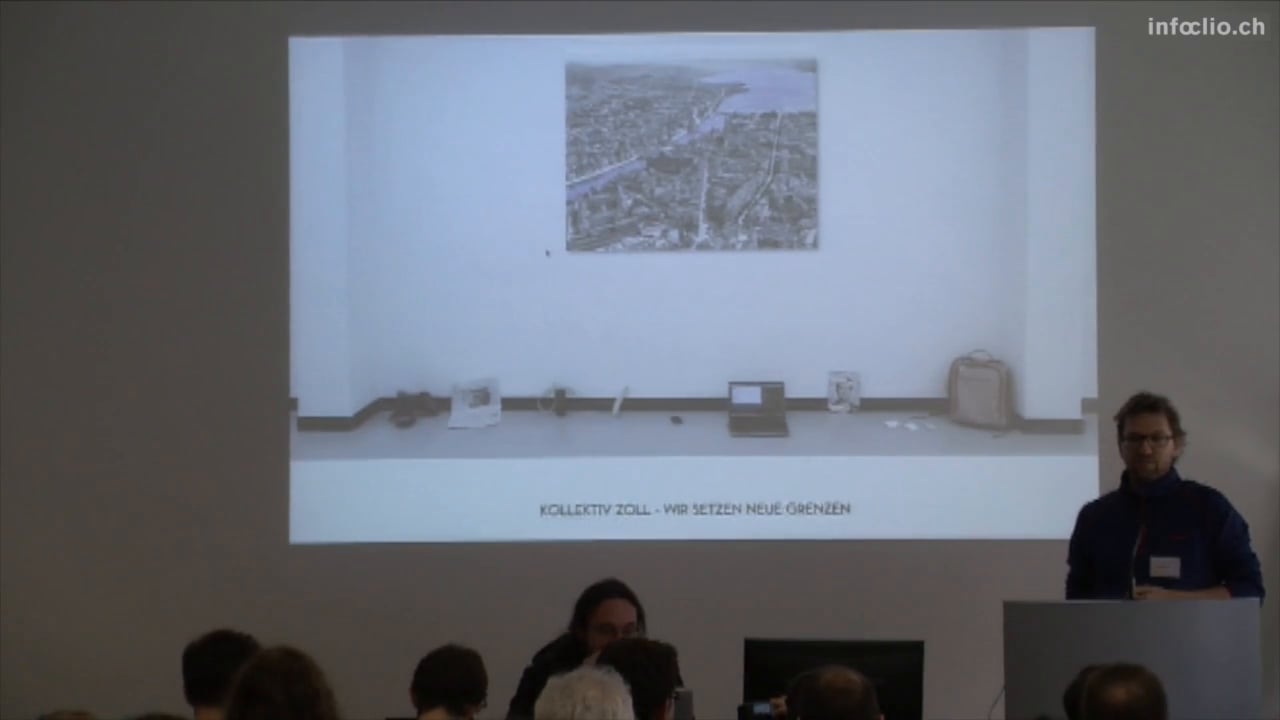
Exploring a water visualisation and sonification remix with Open Data,
to make it accessible for people who don't care about data.

Why water? Water is a open accessible element for life. It
flows like data and everyone should have access to it.

We demand Open Access to data and water.

Join us, we have stickers.

Open Data Used

Tec / Libraries

More than Visualization - More than Soundification — Read More

Latest commit to the master branch on 3-7-2015

Download as zip

Team

Created by the members of Kollektiv Zoll

ToDoes

  • Flavours (snow, lake, river)
  • Image presentation
  • Realtime Input and Processing of Data from an URL

See it live

Solothurner Kościuszko-Inventar

infoclio.ch Vorträge
Saturday, 28. February 2015

Webapp Eduard Spelterini

infoclio.ch Vorträge
Saturday, 28. February 2015

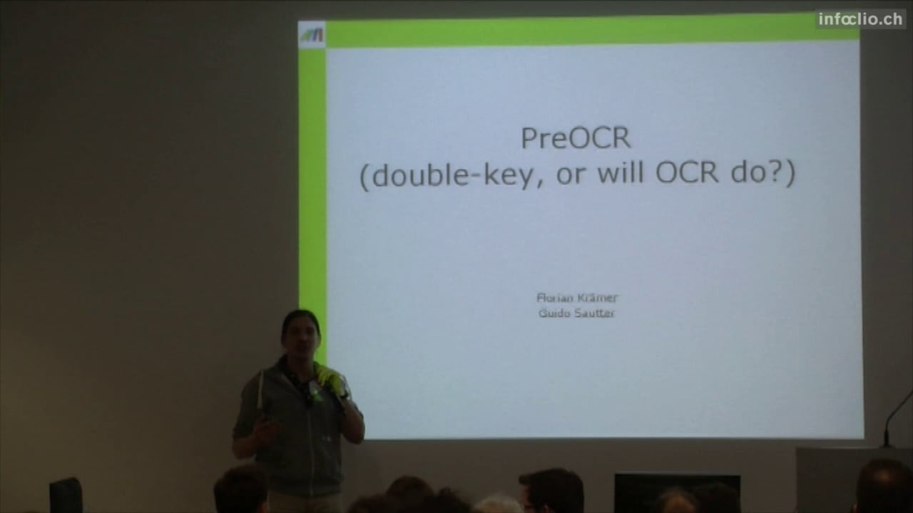
PreOCR

infoclio.ch Vorträge
Saturday, 28. February 2015

Beat Estermann

Infoclio Interview
Friday, 1. July 2016

Interview with Beat Estermann, Project Coordinator Open Cultural Hackathon 2016

Felix Winter

Infoclio Interview
Friday, 1. July 2016

Interview mit Felix Winter, Vice-Director University Library Basel

Oleg Lavrovky

Infoclio Interview
Friday, 1. July 2016

Interview mit Oleg Lavrovky, Opendata.ch

Animation in the spirit of dada poetry

infoclio.ch Vorträge
Saturday, 2. July 2016

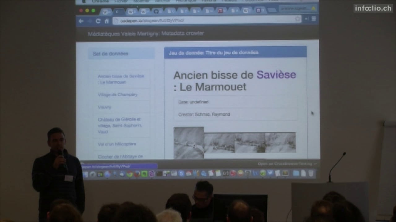
The computer produces animations. Dada! All your artworks are belong to us. We build the parameters, you watch the animations. Words, images, collide together into ever changing, non-random, pseudo-random, deliberately unpredictable tensile moments of social media amusement. Yay!

For this first prototype we used Walter Serner’s Text “Letzte Lockerung – Manifest Dada” as a source. This text is consequently reconfigured, rewritten and thereby reinterpreted by the means of machine learning using “char-rnm”.

Images in the public domain snatched out of the collection “Wandervögel” from the Schweizerische Sozialarchiv.

Data

Latest commit to the master branch on 7-6-2016

Download as zip

Team

Performing Arts Ontology

infoclio.ch Vorträge
Saturday, 2. July 2016

The goal of the project is to develop an ontology for the performing arts domain that allows to describe the holdings of the Swiss Archives for the Performing Arts (formerly Swiss Theatre Collection and Swiss Dance Collection) and other performing arts related holdings, such as the holdings represented on the Performing Arts Portal of the Specialized Information Services for the Performing Arts (Goethe University Frankfurt).

See also: Project "Linked Open Theatre Data"

Data

Project Outputs

2017:

2016:

Resources

Team

  • Christian Schneeberger
  • Birk Weiberg
  • René Vielgut (2016)
  • Julia Beck
  • Adrian Gschwend

Kamusi Project: Every Word in Every Language

infoclio.ch Vorträge
Saturday, 2. July 2016

We are developing many resources built around linguistic data, for languages around the world. At the Cultural Data hackathon, we are hoping for help with:

  • An application for translating museum exhibit information and signs in other public spaces (zoos, parks, etc) to multiple languages, so visitors can understand the exhibit no matter where they come from. We currently have a prototype for a similar application for restaurants.
  • Cultural datasets: we are looking for multilingual lexicons that we can incorporate into our db, to enhance the general vocabulary that we have for many languages.
  • UI design improvements. We have software, but it's not necessarily pretty. We need the eyes of designers to improve the user experience.

Data

  • List and link your actual and ideal data sources.

Team

Historical Dictionary of Switzerland Out of the Box

infoclio.ch Vorträge
Saturday, 2. July 2016

The Historical Dictionary of Switzerland (HDS) is an academic reference work which documents the most important topics and objects of Swiss history from prehistory up to the present.

The HDS digital edition comprises about 36.000 articles organized in 4 main headword groups:

- Biographies,

- Families,

- Geographical entities and

- Thematical contributions.

Beyond the encyclopaedic description of entities/concepts, each article contains references to primary and secondary sources which supported authors when writing articles.

Data

We have the following data:

* metadata information about HDS articles Historical Dictionary of Switzerland comprising:

  • bibliographic references of HDS articles
  • article titles

* Le Temps digital archive for the year 1914

Goals

Our projects revolve around linking the HDS to external data and aim at:

  1. Entity linking towards HDS

    The objective is to link named entity mentions discovered in historical Swiss newspapers to their correspondant HDS articles.
  1. Exploring reference citation of HDS articles

    The objective is to reconcile HDS bibliographic data contained in articles with SwissBib.

Named Entity Recognition

We used web-services to annotate text with named entities:

- Dandelion

- Alchemy

- OpenCalais

Named entity mentions (persons and places) are matched against entity labels of HDS entries and directly linked when only one HDS entry exists.

Further developments would includes:

- handling name variants, e.g. 'W.A. Mozart' or 'Mozart' should match 'Wolfgang Amadeus Mozart' .

- real disambiguation by comparing the newspaper article context with the HDS article context (a first simple similarity could be tf-idf based)

- working with a more refined NER output which comprises information about name components (first, middle,last names)

Bibliographic enrichment

We work on the list of references in all articles of the HDS, with three goals:

  1. Finding all the sources which are cited in the HDS (several sources are cited multiple times) ;
  2. Link all the sources with the SwissBib catalog, if possible ;
  3. Interactively explore the citation network of the HDS.

The dataset comes from the HDS metadata. It contains lists of references in every HDS article:

Result of source disambiguation and look-up into SwissBib:

Bibliographic coupling network of the HDS articles (giant component). In Bibliographic coupling two articles are connected if they cite the same source at least once.
Biographies (white), Places (green), Families (blue) and Topics (red):

Ci-citation network of the HDS sources (giant component of degree > 15). In co-citation networks, two sources are connected if they are cited by one or more articles together.
Publications (white), Works of the subject of an article (green), Archival sources (cyan) and Critical editions (grey):

Team

Visualize Relationships in Authority Datasets

infoclio.ch Vorträge
Saturday, 2. July 2016


Raw MACS data:

Transforming data.

Visualizing MACS data with Neo4j:

Visualization showing 300 respectively 1500 relationships:

Visualization showing 3000 relationships. For an exploration of the relations you find a high-res picture here graph_3000_relations.png (10.3MB)

Please show me the shortest path between “Rechtslehre” und “Ernährung”:

Some figures

  • original MACS dataset: 36.3MB
  • 'wrangled' MACS dataset: 171MB
  • 344134 nodes in the dataset
  • some of our laptops have difficulties to handle visualization of more than 4000 nodes :(

Datasets

Process

  1. get data
  2. transform data (e.g. with “Metafactor”)
  3. load data in graph database (e.g. “Neo4j”)

*its not as easy as it sounds

Team

  • Günter Hipler
  • Silvia Witzig
  • Sebastian Schüpbach
  • Sonja Gasser
  • Jacqueline Martinelli

Dodis Goes Hackathon

infoclio.ch Vorträge
Saturday, 2. July 2016

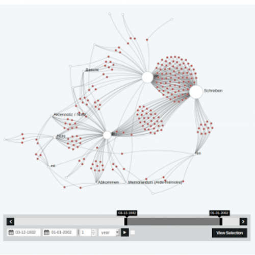
Wir arbeiten mit den Daten zu den Dokumenten von 1848-1975 aus der Datenbank Dodis und nutzen hierfür Nodegoat.


Animation (mit click öffnen):

Data

Team

  • Christof Arnosti
  • Amandine Cabrio
  • Lena Heizmann
  • Christiane Sibille

VSJF-Refugees Migration 1898-1975 in Switzerland

infoclio.ch Vorträge
Saturday, 2. July 2016

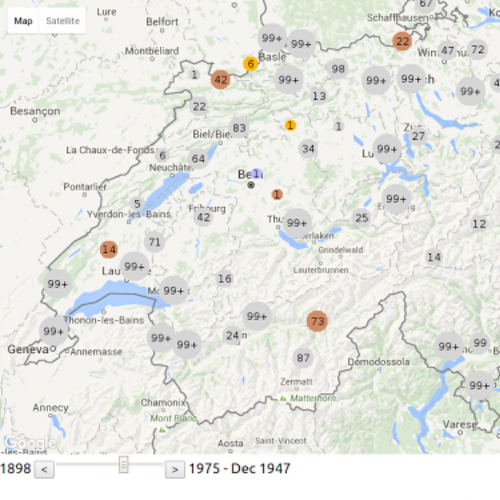
VSJF-Refugees Google Maps Visualization

Online Version

We developed an interactive visualization of the migration flow of (mostly jewish) refugees migrating to or through Switzerland between 1898-1975. We used the API of google maps to show the movement of about 20'000 refugees situated in 535 locations in Switzerland.

One of the major steps in the development of the visualization was to clean the data, as the migration route is given in an unstructured way. Further, we had to overcame technical challenges such as moving thousands of marks on a map all at once.

The journey of a refugee starts with the place of birth and continues with the place from where Switzerland was entered (if known). Then a series of stays within Switzerland is given. On average a refugee visited 1 to 2 camps or homes. Finally, the refugee leaves Switzerland from a designated place to a destination abroad. Due to missing information some of the dates had to be estimated, especially for the date of leave where only 60% have a date entry.

The movements of all refugees can be traced over time in the period of 1898-1975 (based on the entry date). The residences in Switzerland are of different types and range from poor conditions as in prison camps to good conditions as in recovery camps. We introduced a color code to display different groups of camps and homes: imprisoned (red), interned (orange), labour (brown), medical (green), minors (blue), general (grey), unknown (white).
As additional information, to give the dots on the map a face, we researched famous people who stayed in Switzerland in the same time period. Further, historical information were included to connect the movements of refugees to historical events.

Data

Code

Team

Manesse Gammon

infoclio.ch Vorträge
Saturday, 2. July 2016

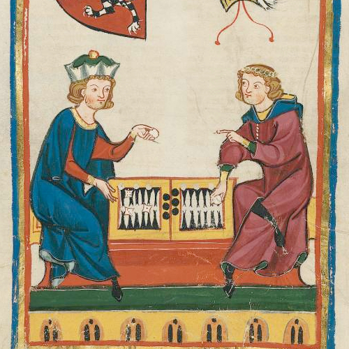
The Codex Manesse, or «Große Heidelberger Liederhandschrift», is an outstanding source of Middle High German Minnesang, a book of songs and poetry the main body of which was written and illustrated between 1250 and 1300 in Zürich, Switzerland. The Codex, produced for the Manesse family, is one of the most beautifully illustrated German manuscripts in history.

The Codex Manesse is an anthology of the works of about 135 Minnesingers of the mid 12th to early 14th century. For each poet, a portrait is shown, followed by the text of their works. The entries are ordered by the social status of the poets, starting with the Holy Roman Emperor Heinrich VI, the kings Konrad IV and Wenzeslaus II, down through dukes, counts and knights, to the commoners.

Page 262v, entitled «Herr Gœli», is named after a member of the Golin family originating from Badenweiler, Germany. «Herr Gœli» may have been identified either as Konrad Golin (or his nephew Diethelm) who were high ranked clergymen in 13th century Basel. The illustration, which is followed by four songs, shows «Herrn Gœli» and a friend playing a game of Backgammon (at that time referred to as «Pasch», «Puff», «Tricktrack», or «Wurfzabel»). The game is in full swing, and the players argue about a specific move.

Join in and start playing a game of backgammon against «Herrn Gœli». But watch out: «Herr Gœli» speaks Middle High German, and despite his respectable age he is quite lucky with the dice!

Instructions

You control the white stones. The object of the game is to move all your pieces from the top-left corner of the board clockwise to the bottom-left corner and then off the board, while your opponent does the same in the opposite direction. Click on the dice to roll, click on a stone to select it, and again on a game space to move it. Each die result tells you how far you can move one piece, so if you roll a five and a three, you can move one piece five spaces, and another three spaces. Or, you can move the same piece three, then five spaces (or vice versa). Rolling doubles allows you to make four moves instead of two.

Note that you can't move to spaces occupied by two or more of your opponent's pieces, and a single piece without at least another ally is vulnerable to being captured. Therefore it's important to try to keep two or more of your pieces on a space at any time. The strategy comes from attempting to block or capture your opponent's pieces while advancing your own quickly enough to clear the board first.

And don't worry if you don't understand what «Herr Gœli» ist telling you in Middle High German: Point your mouse to his message to get a translation into modern English.

Updates

2016/07/01 v1.0: Index page, basic game engine

2016/07/02 v1.1: Translation into Middle High German, responsive design

2016/07/04 v1.11: Minor bug fixes

Data

Author

Historical maps

infoclio.ch Vorträge
Saturday, 2. July 2016

The group discussed the usage of historical maps and geodata using the Wikimedia environment. Out of the discussion we decided to work on 4 learning items and one small hack.

The learning items are:

  • The workflow for historical maps - the Wikimaps workflow
  • Wikidata 101
  • Public artworks database in Sweden - using Wikidata for storing the data
  • Mapping maps metadata to Wikidata: Transitioning from the map template to storing map metadata in Wikidata. Sum of all maps?

The small hack is:

  • Creating a 3D gaming environment in Cities Skylines based on data from a historical map.

Data

This hack is based on an experimentation to map a demolished and rebuilt part of Helsinki. In DHH16, a Digital Humanities hackathon in Helsinki this May, the goal was to create a historical street view. The source aerial image was georeferenced with Wikimaps Warper, traced with OpenHistoricalMap, historical maps from the Finna aggregator were georeferenced with the help of the Geosetter program and finally uploaded to Mapillary for the final street view experiment.

The Small Hack - Results

Our goal has been to recreate the historical area of Helsinki in a modern game engine provided by Cities: Skylines (Developer: Colossal Order). This game provides a built-in map editor which is able to read heightmaps (DEM) to rearrange the terrain according to it. Though there are some limits to it: The heightmap has to have an exact size of 1081x1081px in order to be able to be translated to the game's terrain.

To integrate streets and railways into the landscape, we tried to use an already existing modification for Cities: Skylines which can be found in the Steam Workshop: Cimtographer by emf. Given the coordinates of the bounding box for the terrain, it is supposed to read out the geometrical information of OpenStreetMap. A working solution would be amazing, as one would not only be able to read out information of OSM, but also from OpenHistoricalMap, thus being able to recreate historical places. Unfortunately, the algorithm is not working that properly - though we were able to create and document some amazing “street art”.

Another potential way of how to recreate the structure of the cities might be to create an aerial image overlay and redraw the streets and houses manually. Of course, this would mean an enormous manual work.

Further work can be done regarding the actual buildings. Cities: Skylines provides the opportunity to mod the original meshes and textures to bring in your very own structures. It might be possible to create historical buildings as well. However, one has to think about the proper resolution of this work. It might also be an interesting task to figure out how to create low resolution meshes out of historical images.

Team

  • Susanna Ånäs